 |
|
Click on any name on the route to go to the story
for that place
|
It is hard to know what to say about Ephesus. It is one of the best known and most visited sites in Turkey. It is also one of the biggest and most important classical sites anywhere. It flourished for the best part of a thousand years. St. Paul preached there and caused a riot by advocating the worship of Christ instead of Artemis. It was a major seaport and cultural centre, but it died when the River Meander finally silted up the harbour so that it could no longer be used as a port. Now it is three or four kilometers from the sea, and most of the magnificence it must have had is in ruins, a lot of it unexcavated. But despite the crowds and the fragmentary state of most of the buildings of which there is any sign, it is still an inspiring place to visit.
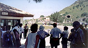 |
| The ticket booth at the East entrance |
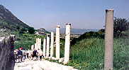 |
| Near the head of the main street. |
There are two entrances, both surrounded by kiosks and hawkers, the one nearest the sea (the downhill end) much more so than the other, which was where we entered the site.
The entrance is at one end of one of the main streets. Like most Graeco-Roman sites we visited, Ephesus has a colonnaded main street of considerable length. The other end of the main street is in the ploaza in front of the great Library. At that point, the main street turns right, and passed through a triumphal gate built under Hadrian. At the Theatre, the street turns left again and passes alongside the Agora, but the public path shortly turns right off that street to the West (seaward) entrance, outside which there is a long double row of souvenir and fast food booths, not to mention foreign exchange possibilities.
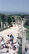
Here are several pictures of some of the places along this upper main street. As with all the other thumbnails in these pages, you can click on any of the pictures to see a larger version.
 |
 |
 |
 |
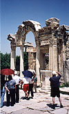 |
| Some scenes along the upper main street. (Left) Looking down toward the Library. (Left middle) The goddess Nike (the stone one, of course!) This goddess didn't need running shoes. (Right middle) A small theatre or Odeon. (Right) The public toilets, which apparently were a place for meeting people. They were flushed by running water underneath. (Far Right) An entrance arch to a temple of Hadrian, with a frieze showing Amazon warriors. | ||||
 |
 |
 |
 |
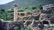
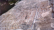
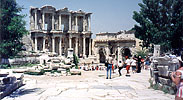
| These houses were the residences of ordinary citizens. Others are currently being excavated nearby. | A geometric mosaic outside one of the houses. I took this because most of the mosaics we saw were figurative, or in bad condition. | The great Library. Alexander plundered it to provide the basis for the great Library of Alexandria. The arch to the right of the Library facade was built by Hadrian about 500 years after the Library. |
The Library is now little more than a facade, though the floor and inner walls of the main central room still exist behind the facade. I say "inner walls" because the Library had an ingenious system of double walls to ensure air circulation to help preserve the books. There was about a metre between the inner and outer walls, helping keep the books cool and dry in the summer, and warm in the winter, to reduce the risk of mildew or other damage. Until Alexander came along and took most of the collection to start his Library in Alexandria, this Library held one of the greatest collections in the Western World.
After passing the Library, the tourist route takes the road through Hadrian's arch, at right angles to the long road down which we started. This road takes us to the great theatre and the Agora. The tourist route follows the road past the Agora only a few tens of metres, and then branches off to the exit--the more used entrance to the site, where dozens of kiosks, salesmen and women, and buses, lie in wait.
 |
 |
 |
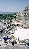
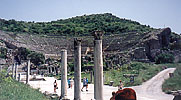
| The large theatre. (Left) The stage and the orchestra. (Middle) The view from the street beside the Agora (Right) The Agora seen over the ruins of the stage. The middle picture was taken from the road in the middle distance. |
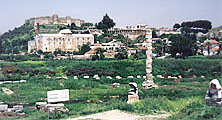 |
| Four antiquities in one picture: Top, a Selc.uk fortress; below the fortress, a Selc.uk mosque, both 13th (?11th) century. Above the standing column, the church in which legend says St John write his Gospel. In the forground, what remains of the Temple of Artemis, one of the 7 Wonders of the Ancient World. |
 |
| The house of Mary, where it is said she lived when St John brought her here after the crucifixion. It is, at least, of the right date. |
There are two other interesting sites in the neighbourhood of Ephesus, as well as the Selc.uk Museum in the nearby town of Selc.uk. I do not know whether the first wave of Turks to come to Anatolia were called Selc.uk after the town, or whether the town was named after them.
The left picture shows four substantial antiquities in one frame. The two large buildings, one on top of the hill and one immediately below it, are Selc.uk, a fortress and a mosque, respectively. The Selc.uk Turks were the first Turks in what is now called Turkey, in the 11th or 13th century (I forget which). Several other waves of Turks followed them, each conquering thier predecessors. The Ottomans were the last. Their Empire lasted until the end of the First World War, when it was broken up.
From Selc.uk a steep climb with some sharp hairpin curves brings us to a park area. On a neighbouring hillside one can see a massive wall, the city wall of Ephesus. Its distance from the tourist centre of Ephesus suggests that the city was very large at one time--perhaps when St. Paul was there to preach to the devotees of Artemis.
At the top of the climb, there is a small stone house. Legend has it that St. John was asked by Christ to take care of Mary after the crucifixion, and St. John brought her to Ephesus. But she did not stay in Ephesus. Instead she moved up to this remote house on top of the hill--almost a mountain. Our guide, Ahmet, thought it was not impossible that she came to Ephesus, but it was unlikely that she would have used that house all year round. As a summer place, perhaps, to get away from the coastal heat. It is old enough for Mary to have lived there, at least. Whatever the truth of the story, a lot of people apparently believe it, and make a pilgrimage to the place.
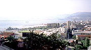 |
| (Above) Overview of Izmir waterfront. .(Below) Construction in the plaza. The ferry at the terminal is visible in both pictures. |
 |
 |
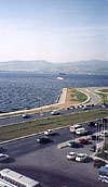 |
| The Izmir waterfront.(Above) The end of the big plaza. (Top Right) The actual waterfront at the side of the plaza. The overview picture to the left was taken from near the mosque at the top of the hill. (Below) The blue-tiled mosque at the top of the hill. (Lower Right) A city street, taken from the same spot as the picture of the mosque, looking the opposite direction. | |
 |
|
 |
Izmir is the modern name for Smyrna, which had been a major centre for many centuries, but very little of old Smyrna is left to see. Izmir is a modern city--at least in part. The waterfront is very dramatically 21st century, a huge pedestrian Plaza backed by polished office blocks, Under and behind the office blocks that face the plaza is a shopping mall in the Western style.The whole area is a new modern centre to the town, but there is also a more normal 20th century downtown to the north of this big waterfront plaza. The main part of the city, beyond the big plaza seems to be clean and well laid out. It looks just like any normal European city. Further along the waterfront (to the right and in the distance in the overview picture) is a substantial industrial and military harbour, but the area in the pictures is clearly intended to be where the people come.
These pictures do not really do the plaza justice. They show neither its great size, nor the fact that despite the size, it seems well proportioned and a comfortable people-area. But it is very much under construction, with grassy areas being constructed before the waterfront road, and large parts of it are roped off because the paving blocks have yet to be laid. In the far right picture, the brownish tinge of the median between the two directions of road travel betray the fact that it is newly dug and seeded.
Up the hill from which the overview picture is taken is an older, less Western, part of the city. I climbed the steps up to the top, and found moderately narrow, rubble-strewn streets with women , in traditional costume stting on the front steps socializing and sewing, while children played soccer in the street. The street in the picture looks fairly typical, but in fact it was not a street at all, but a courtyard.
The reason I went up there was partly so as to take an overview picture, which I had been unable to do from the bus as we came down the same hill, and partly to take a picture of the very pretty blue-tiled mosque we had passed. Ahmet said it was not worth the climb, as the mosque was quite new and therefore not interesting. But I thought it had looked so pretty when we passed it that its lack of age was quite unimportant! From the height of the bus, the mosque had made a fine picture with the city spread below, but on foot, that picture could not be seen, and it was even difficult to get a decent vantage point to take a picture of the mosque. The picture shown here is a poor reflection of how the mosque looks , but it was the best I could do.
The next morning, we had to get up rather early to get to Pergamum (modern Bergamo), and then Troy.