![]()
![]()
 |
|
Click on any name on the route to go to the story
for that place
|
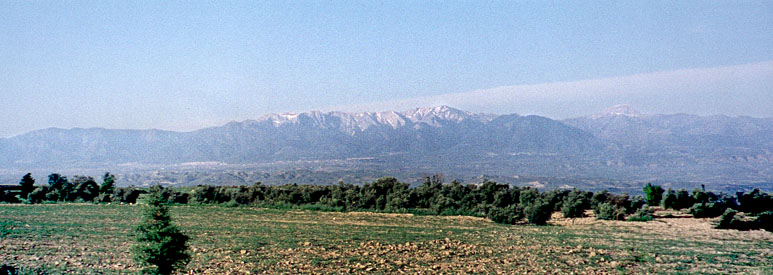
Today's trip took us back northwest through the Toros mountains, but in a much less rugged area than the road from Konya. From Konya, we crossed several east-west ranges; from Antalya we could see a north-south range flanking the bay. Between the two, our road passed through some steep sections, but mostly the terrain was better described as hilly than as mountainous. Quite often, we would pass a valley with fairly steep sides, but a wide, very flat bottom, clearly filled in by erosion. These valleys were always heavily cultivated.
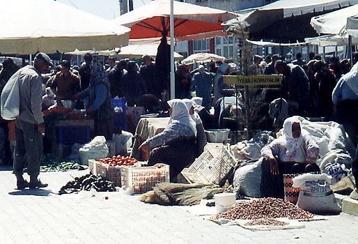
Before lunch, we stopped for a while at a town called Korkatale, where it was market day. The market consisted of stalls selling almost anything you could imagine, like a bazaar--kitchenware, camera accessories, cutlery, camel and donkey saddles, (of course carpets), and all kinds of foods, mostly presumably brought in fresh from the surrounding farms. It covered several city blocks in both directions, and seemed to be a place where people would expect to find what they wanted on a regular basis. The pictures show empty space, but most of the market was very crowded, making photography rather pointless.
 |
 |
 |
| The market at Korkatale. The stall at the far right was selling camel saddles. The market covered several blocks in both directions. | Women sitting selling tomatoes and nuts, among the more established stalls | Goat cheese, kept insulated from the heat in goatskin bags on which the black hair actually is good insulation. |
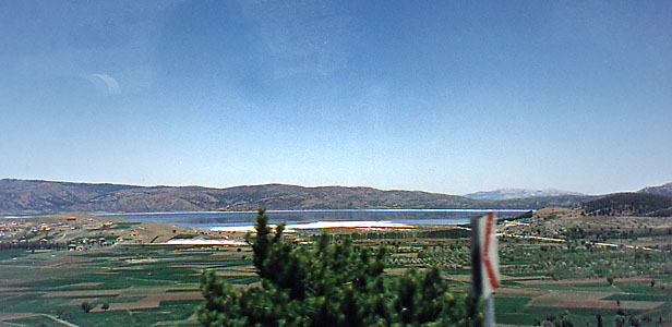
We stopped for lunch at a large, not very good, open-air cafe by a beach on a salt lake. Like the Great Salt Lake, the size of this one varies greatly over the summer. Whe we were there, the beach might have been about 200m wide, but later in the summer, the lakeshore would be much further away. The water looks blue in the pictures, but up close, it does not look very appetizing. It is obviously a tourist spot, because there are kiosks for ice-creams and the like, and donkey and camel rides, and rides in donkey carts, and so forth.
 |
 |
 |
| (Left) At the lunch stop by the salt lake, one of our group poses by a donkey that was being offered for rides. (Above) The other end of the same lake, its now dry bottom used for extensive agriculture. |
In
the fields, it is the women who do the hard manual labour,
and if there are men, they are driving machinery or are otherwise "employed."
|
When we arrived at Pamukkale, which means "Cotton Castle," we first were taken across the road below the face of the mineral deposit. Pamukkale is the result of a mineral spring that has been flowing for thousands, probably millions, of years. The minerals form flat pools that fall in steps down the hillside. Where the travertine surface is recently washed and has a new surface, it is dazzling white, but over time it ages to a mid-to-dark grey. If you have seen the Mammoth Hot Springs at Yellowstone National park in the USA, the pools are very similar, except for being white instead of yellow or the other bacterial colours often seen at Yellowstone. But Yellowstone has (so far as I remember) nothing to compare with the Pamukkale high thin walls that snake long distances across the plain.
 |
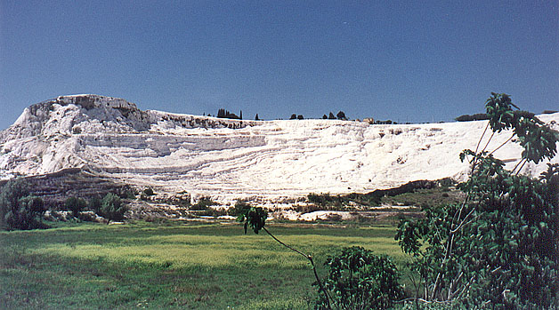 |
| Pamukkale. General view of the mineral flow. Notice the wall-like ridges both in the foreground and in the background. | Pamukkale. The main face of the travertine deposits. Later, we went up on top. Notice the marshy field in the foreground. |
 |
| Overview of the Necropolis. Much is yet to be excavated. |
 |
| Family tombs on the main street of the Necropolis. |
Before actually visiting Pamukkale we continued to the other side of the springs to visit the Pergamum/Roman city of Hierapolis, which extends over the top of the white wall. (We will talk about the Pergamum kingdom, part of the breakup of the Empire of Alexander, later in the trip, after we visit Ephesus).
Beside Hierapolis there a large Roman necropolis, which was where they buried their dead, outside the city on the side away from Pamukkale. The bodies were laid on benches inside the family tombs, rather than being buried in the ground.
The city of Hierapolis lies over the ridge in the distance in the left picture of the Necropolis. It is named after the goddess Hiera, and has nothing to do with "hierarchy" or "hieratic." It was founded as a spa beside the mineral hot springs in Pergamum times, which means around 200 BC. Hierapolis was a living city for about 800 years, but was abandoned after one too many earthquakes. Not much of it has been excavated, as you can see in the picture. The main street and the gate have been somewhat restored, but otherwise the stones lie scattered where they fell--those that have not been scavenged for building materials over the centuries.
 |
 |
| The main gate of Hierapolis, with a little of the main street visible beyond. | The field of ruins of the unexcavated agora, with the theatre in the distance. |
At the other end of the main street of Hierapolis is the top of the Pamukkale mineral pools. Until recently, there were three luxury hotels there on the very edge of the Pamukkale formation. They had diverted the mineral springs to feed their swimming pools, and had thereby disrupted the normal flow. Two of the hotels have now been pulled down, and the last one is scheduled to be destroyed, but the damage to the underground stream configuration cannot be remedied. What they do now, is to send the waters along troughs that are successively diverted into the different pools. It used to be popular to wade in the pools, which are pleasantly warm, but that is now illegal except in one set of pools at the very end of the formation, which have been designated for wading. Those pools are out of this picture, far to the left.
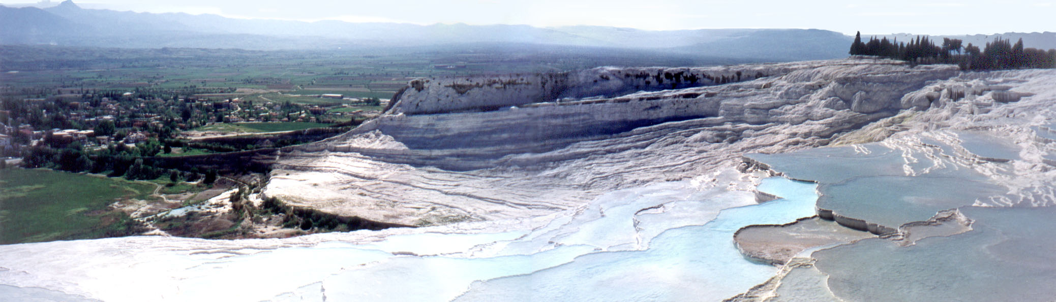 |
| Some of the travertine basins at the top of the Panukkale formation. Click to get a panorama you can scroll. |
 |
 |
 |
| (Left) This looks like a branching man-made drainage channel, but it's a travertine wall made by the flow of mineral water. (Middle) several such walls in a fossil part of the formation. (Right) A big wall, several metres high that goes a long way across the fields. |
One of the most extraordinary features of the Pamukkale formation is the set of large and small walls that snake out sometimes for long distances over the countryside.They are tall and very thin, no matter how long they are. You can see two big ones at the left of the panorama picture above. Here are some more pictures.
The walls are created by the same mechanism as the basins--precipitation of the minerals as the water cools (a better explanation is here). To my mind they are more interesting and spectacular than the basins, but most of the tourists seemed not to notice them at all. Some of the big fossil walls seem to be kilometers long, near the necropolis. Over the thousands of years the spring has been flowing, it seems to have changed its point of outlet quite a bit, and I suspect that both Hierapolis and its necropolis may be built on fossil parts of the formation. The city wall of Hierapolis in the left picture above may have been what blocked the flow to the nascent wall in the picture. If that is true, this little natural wall has been dead for around 2000 years. The hotels on the crest certainly changed the flow of the spring, and depleted it, before they were torn down recently.
You can see much more about Pamukkale and Hierapolis here.
 |
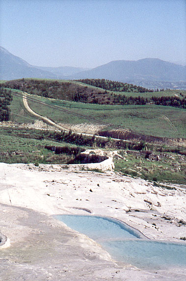
We left Pamukkale early, but not too early for me to try to see more of the travertine walls. I started to walk from the hotel back toward Pamukkale, but it turned out to be much too far, given the available time. Nevertheless, I was able to take an early-morning picture of the valley into which the mineral springs flow, and along which we would drive on our way to Ephesus.
The road from Antalya to Ephesus cuts a diagonal across the southwest corner of Turkey, with Pamukkale about half-way. So the drive to Ephesus was quite long. Unlike yesterday's drive, today's was mostly along a wide valley flanked by low mountains, through fig orchards, olive groves, and the like. A pleasant country. Much of the route expressway, in contrast to the winding two-lane roads to which we had become accustomed ever since leaving Istanbul.