Some pictures I took along the Humber River through and near Weston, the morning
after Hurricane Hazel came through Toronto in 1954. Click on any of them to
see a bigger version. We knew nothing of the flood until a friend who had intended
to visit from Etobicoke called to say he could not come because there were no
bridges across the river. Around 10 am, we went to have a look. By that time,
the river level was far below its crest, but it was still high enough to be
pretty dramatic.
 |
 |
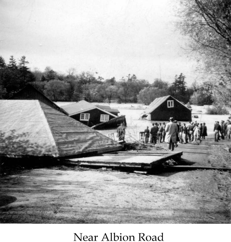
| 1. Albion Road used to cross the Humber over this metal girder
bridge. After the hurricane, it was replaced with a concrete bridge a hundred
metres or so further south, where Albion Road now crosses the Humber. A
little south of this, there was a new bridge that had just opened to carry
Highway 401 across the Humber. It, or its approaches, were washed away,
and the bridge was rebuilt a bit higher over the water before the 401 was
truly opened across the river. |
2. You can tell how much the river
level had gone down by the time we saw it. A car was washed off
the road here, and you can see how the river flow over the road
has eroded the embankment. I don't remember which road this is,
but it is either Albion Road (in which case the girder bridge
was an already obsolete bridge for Albion Road--this seems most
likely) or near Albion Road. |
 |
 |
| 3. This house, according to my memory,
was floating when we saw it. But the pictures seem to show that
it is grounded. Either way, it had floated from further upstream.
This is a couple of kilometers north of where the street of houses
was washed away with a large loss of life. |
4. Another view of the house that
may or may not have been floating. The picture was taken from
well below the high-water mark, as can be seen from the nearer
debris, parts of a house that had floated downstream. |
 |
 |
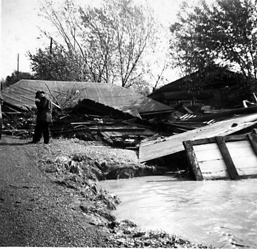
| 5. Another view of the debris of
broken houses, showing the power of the river. |
6. This picture is taken looking
north from a high railway bridge that passed at the time over
the second hole of Weston Golf Club. The new Highway 401 is visible
in the distance. Its bridge had just been opened, but was washed
out. |
 |
 |
|
7. Lawrence Avenue crossing the Humber, connecting Weston
Road and Scarlett Road. The water level had been completely over
the bridge.
Looking to the left and backward from this viewpoint is where
the river had gone straight over a bluff and taken out a complete
street of houses, killing something like 140 people. By the time
this picture was taken, the main river was in its course, but
was flowing very fast, so that it was banked up against the curve
of the bluff, and there was a standing wave head-high above the
level of the bank on this side of the river.
|
8. St. Phillips Road connects Weston
Road to Scarlett Road north of Lawrence. On the other side of
the river is the entrance to Weston Golf Club. The point from
which this picture was taken was about 10 ft below the high water
mark of the flood, so this bridge had been completely underwater
by at least 10 ft. |