Overnight, despite the clear evening, there was heavy but brief rain, and the balcony walkway was filled with deep pools. The design of drains was not the forte of whoever created this otherwise wonderful hotel! After another nice breakfast, this time not quite alone, the weather cleared up, and the Sixt man came with the rental car. For the rest of the day, it was mostly sunny, though we could often see showers, one of which came our way.
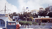
First we went to Pirgos (sometimes Pyrgos), which covers the top of a small hill about 4 km from the hotel. Climbing up the hill involves a maze of small passages between high walls, and one often feels that one is likely to be reaching a dead-end in someone's garden. But eventually the path opens up on the higher of two churches with the classic Santorini blue roof. Either the church or the area is called Kastelli, which presumably means it was fortified, though it isn't now.
We could not go into the church, because they were having a Good Friday service, with some impressive singing audible outside. One can get up onto the flat roof beside the blue dome for a fine view over the southern half of the island, from Fira to Akrotiri. The picture shows how the island slopes relatively gently down to the seacoast at the east side of the island from the caldera cliff.
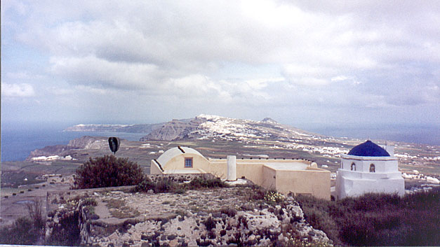
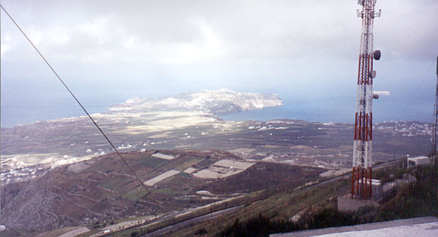
The highest point on Santorini is Profiti Ilias, not far from Pirgos. The peak is shared between a monastery and a military base with an amazing array of antenna masts. The road up is steep and narrow. One is always hoping that nothing is coming around the next hairpin. At the top, there is parking for about 4 very small cars, which is how many were there, but by a bit of juggling we were able to find a spot. Although it was Good Friday, we were able to go into a small church. It was very dark, but when our eyes became accustomed to it, we could see an imposing mosaic of Jesus in the dome, and many icons and decorations lower down. Quite a few people were there, kissing the icon of Mary and Child.
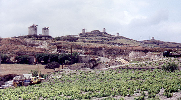 |
Back down the hairpins to the main road (which was the one along the cliff edge that we were driven along at night when we arrived from the ferry), and then to Perissa. In the picture from Profiti Ilias, this means going from the right side of the picture to the left, just beyond the nearest hill. There is a low ridge line that you can make out in the big version of that picture, and along the ridge there is a row of the same kind of stone windmills we saw at the edge of the Plateau of Lassithi in Crete. These ones were equally disused, to judge by the lack of sails. From Perissa, our guide book said it was half an hour walk to Ancient Thera.
 |
 |
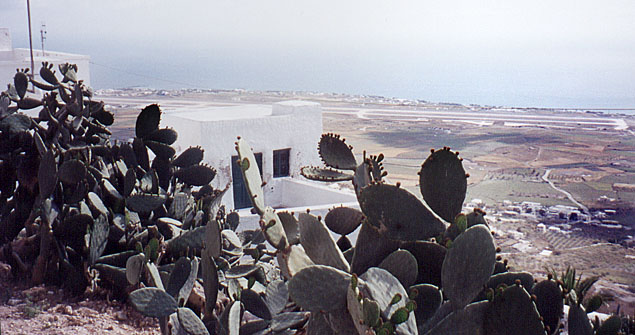
| Starting the climb up toward Ancient Thera The rock slope in the background is the one at the bottom left of the picture from Profiti Ilias. |
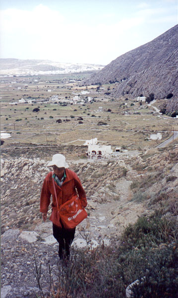
Perissa is a beach town, primarily for tourists, or at least so it looks. There were no signs in town to tell us where to park for the path to Ancient Thera, but we continued on and eventually found a signed parking place and a footpath leading up the hill. The guidebook had said nothing about the site being on a hill, and we really did not guess what we were in for. We climbed up and up a narrow path, sometimes with unpleasantly steep drops to the side, though never sheer. There were a couple of crosses on side paths, representing presumably places where people had fallen and been killed.
Eventually we rounded a shoulder of the hill and were nearly blown away by the blast of wind. We could see the path continuing up to a saddle between Profiti Ilias and the hill we were on. There was no way of knowing how far Ancient Thera was beyond what we could see, and we figured that with the wind so heavy where we were, it would be ferocious on the saddle, so we gave up on Ancient Thera and went back to the car.
On the way down we met a couple of other groups. Maybe they went all the way up, but I have my doubts. The next day, we discovered that the saddle was actually the entrance to Ancient Thera, which covered the top of the hill we were on. So we could have got there, but as we also found out the next day, the wind had been bad enough to scare people away from going up to it once they had arrived at the saddle. So it was just as well we gave up.
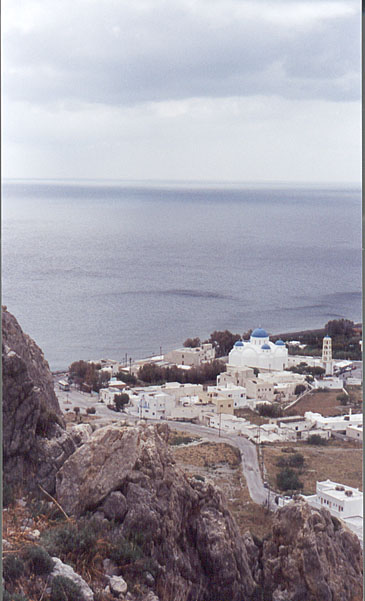
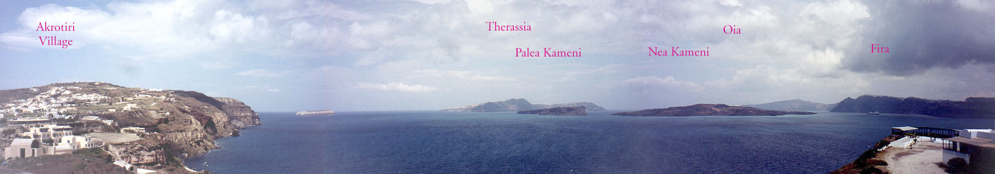
After failing to reach Ancient Thera, we went to Akrotiri. Just short of the modern town, there is a fine viewpoint back along the caldera wall toward Fira, and beyond the volcano to Oia. Here is a panorama that you can scroll across using the scroll bars at the bottom of your window (it is the same panorama you can see by clicking near Akrotiri on the Santorini map on Page 1 of the Santorini part of the story).
 |
The site of Ancient Akrotiri is on the south coast, away from the caldera, perhaps 2km south of the modern village. We went there to look but we didn't want to see the site until we had eaten. It was a bit early for lunch, so we walked along the shore to the "Red Beach" which was more rusty than read, and was otherwise nothing special.
For lunch, we initially decided to eat at a place on the beach, the fish-tavern "Dolphin" but we left after looking at the prices on the menu, and went into town to a local taverna. We should have stayed at the Dolphin, because at the taverna we got the worst meal of our whole trip. The place was nice, outside under a split bamboo roof, and the service was family-friendly, but the food was barely edible.
After lunch, we visited the archaeological site. Since very little (they say about 3%) of the town has been excavated, the visit is quite unlike visiting any of the other ancient sites we saw. The site is covered entirely by a roof, and one cannot wander among the ruins. There is a plank walkway that you follow from the entrance around a circuit and back to the same entrance. What you can see from the walkway is what you can see. It is too dark to take effective photos, at least with my camera, so I have no pictures here. However, here is a site with a lot to say and show about Akrotiri. And here is another that talks more about the Thera eruption as well as about Akrotiri.
The town was deeply buried by the ashfall from the caldera explosion 3600 years ago, in the same way Pompeii was buried 1900 years ago--so it is almost twice as old as Pompeii. However, even in these early stages of excavation, wonderful things have been found. Precursory earthquakes apparently induced the inhabitants to leave at least one year, and perhaps five, before the big explosion, taking most of their valuables with them. No bodies have been found, and a big jar of seeds had been toppled off a shelf and not picked up for at least as long as it took the seeds to germinate and sprout.
Even though they took their valuables with them, the inhabitants couldn't take their wall frescos, which were beautifully done. None that have been excavated are left in the town. They are in museums, some in Fira, but more in Athens. We didn't see it, but one of them is said to show what seems to be a ring city with rings of water and land surrounding a central hill. (A very large scrolling panorama of this frieze is here, reconstructed from a variety of pictures of its parts, found in various places on the Web). This agrees both with the geologists description of how the Santorini/Thera islands looked before the explosion and with Plato's description of the configuration of the city of Atlantis. As much as the obvious wealth and the lack of fortification, and the fact that the ring and the central volcano island disappeared overnight without a trace into the sea, makes the association of Santorini with Atlantis very tempting. (A discussion of the Atlantis Legend is here, with extensive argument as to why the story should be taken as true in its essentials).
Akrotiri must have been a large town, as well as a rich one, since one of the books I have read since returning mentions that it seems to extend at least as far away from the outer coast as the modern village on the caldera edge. Even so, Akrotiri was probably only a suburb of the main town, which would have been on the central volcano that disappeared in the great explosion. We will probably never know whether this was actually the case, but it seems likely. Let us call that vanished central city "Atlantis City"! (A discussion of the so-called Marine Festival fresco we did not see, based on pictures of it found on the Web, is here. I suggest that it shows a fleet travelling from Atlantis City to Knossos for an annual festival.
We followed a group with an English-speaking guide around the site, which helped a lot in interpreting what we saw--the sewer system, for example, is something we would not have understood on our own; the town was well constructed from a sanitary viewpoint (as was Knossos). We looked for Mason's Marks or other writing, but saw none. At the end we asked the guide but she did not understand the question. We did notice something that may or may not have been a coincidence. Two public "triangular squares" that were said to have been used for religious and social meetings both had the shape and proportion of the triangles that form part of several of the Mason's marks characters at Phaestos and Malia.
Fira extends uphill along the caldera edge to Firostefani and then around the bay to Imerovigli (sometimes called Merovigli). These are officially separate towns, though the casual visitor would never guess they were not all the same town. We drove to Firostefani and then walked around exploring. A big church was holding a service that was broadcast outside by powerful loudspeakers. The service included some wonderful powerful music that we stopped to enjoy for some time. I'd like to know what it was. Also there was a sermon. Of course, we could not understand the words, and it was amazing (and amusing) how exactly it sounded like the sermon in one of the Mr. Bean skits!
In Firostefani, we stopped in a nice cafe cantilevered over the cliff edge with a wonderful view, and had a glass of the delightful concoction they call frappe--basically iced coffee, but better than that. From there we wandered around to Merovigli, the highest point along that part of the caldera wall. There we took this panorama (which you can see also by clicking on the appropriate point on the map on the previous page).
Remember that this was Orthodox Good Friday. One of the ways the Greeks seem to celebrate Easter is by making bangs--as loud and as often as they can. In Imerovigli, every low wall other than those along the caldera cliff walk seemed to have a series of pop-cans or the like set at about 1m intervals, with strips of cloth protruding from them. Presumably the cans were stuffed with explosive or gasoline, and the cloth acted as a touch paper. We imagined that somebody would run along them with a flame so that they would go off one after the other. Even in the afternoon, we heard big bangs now and then, mixed with the bells from many churches.
In Fira we bought some more wine and took it back to the hotel to watch the sun go down--but the clouds did not allow us a good sunset. All the same, the water was silver instead of red, and it was very pretty.
After having drunk half the wine, we took the hotel shuttle but back to Fira, where we saw some unexpected Good Friday celebrations (as well as having a nice fish supper at Naussa, where we had lunch the first day).
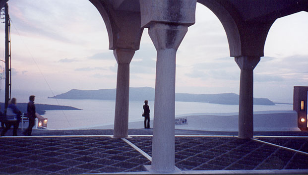 |
| Last light near the Cathedral |
First, we went to the cathedral to see the last of the sunset, but what we saw instead was a double line of soldiers, as if to form an honour guard for a VIP, but there was no VIP, just lots of people going in and out. We went to the door to look in, and what we saw was people going in, lighting a taper and putting it on a stand. Some people went to the middle to walk around or to kneel and kiss a strange construction of unknown import. It was too dark for my camera, and pointless to try a flash, so there are no pictures of this evening.
While we were having dinner, we saw a procession: a large icon, followed by a huge crown and other stuff being carried, then priests and choirboys, followed by people carrying candles. Some people broke off from the procession and came down our street instead of following the rest. After dinner, we saw more ceremony. In the main square there was someone talking--a Patriarch, to judge from the elaborate gold and white costume--and a huge crowd filling the square, most of them with lit tapers.
When the sermon finished, there was another procession back to the cathedral. There were two big icons, 3 big crosses, a construction that looked like a model cathedral and could have been made of flowers, followed by the "Patriarch" and others, and then the general public. We went across back to the cathedral rather than following the procession, and were just in time to see the cathedral model being carried in--it may have been the construction that people had been kissing in the cathedral earlier.
